Edinburgh and back again
Sunday. Easter Weekend and I’d an invitation to go see friends in Edinburgh, so a perfect chance to give my new toy, a Garmin Edge 800, a solid test. Not really sure of the best way to go, so I’d plotted a route on bikeroutetoaster and exported it to the Edge. The course was mostly bits of A-road trying to follow the M8 fairly closely, to keep it reasonably short and hopefully avoid too much traffic, guessing most folk would be on the M8 itself. The unit lived up to my expectations, giving decent warnings of upcoming turns, round-a-bouts and anything else requiring a change in direction. The first section of my route out of Glasgow gave it a bit of workout, as a section of the London Road is closed to traffic, causing the Edge to bleep away as I took the diversion and went “off course”. It set about recalculating a way to get back on track, so not so different to car sat nav, but with all the extras of a bike computer (cadence, HR monitor, speed etc).

.
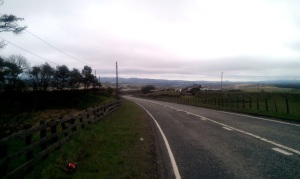
The rest of the route went as planned, the only mishap when I stopped atop a hill around Shotts to take a photo, stopped the Edge and forgot to restart it until I’d been zooming downhill for about 4 miles, messing up my stats. Oh well. This roughly marked the halfway point, and it was pretty much all easy downhill from then on – this is what cycling should be all about – down/ flat sections and easily hitting 20mph+. Just over 2 hours and a nice average of 19.1 mph, with the bonus of no real near-death experiences with cars on the A-roads. I arrived at M&Ts in time for a late morning bacon roll and soon had a beer in my hand followed by a fine afternoon of great company and great food. Yum.
http://connect.garmin.com/activity/166316361
Monday. I’d already loaded the return route on the Edge (using TCX converter to reverse the route from bikeroutetoaster) and set off sans-hangover (good call on some sensible drinking) after thanking my hosts for a great previous day/ night. The Edge immediately tried to take me ‘the wrong way’ as I reckoned the route I take by car would actually be quicker than the route I’d plotted previously. I ignored its beeping and carried on, soon to rejoin the plotted route. The return leg was not such a joy, as the weather had turned for the worse, a bit colder, wetter and the westerly wind making things not the best for cycling. Got to practice using the small chain ring, battling head winds and the first 20 miles of uphill giving me more than enough climbing training. I counted off the miles to Shotts and the relief of the downward section. The constant drizzle somewhat sapped the fun out of the downhills, but focussed on getting my average speed back up to 15mph to take my mind off how wet I was getting. I was soon on familiar roads, so switched the Edge’s screen to show the ‘stats’ instead of the map, and was pleasantly surprised to learn that the unit would automatically switch to the navigation screen at turns/ junctions then back to the stats again. Handy feature, will stick to using this method in future trips. I was soon home again, managed to get the 15mph average, so happy enough with that bearing in mind the conditions.

Ian
Get that auto pause set on the device, which is what the rest of the chaps do. The only time you should start your device is at the, ahem, start of the ride. Then stop at the end.
Lots of big average speeds you’re posting here. You’ll be blowing the Egasa boys away next time out, especially after the warm weather training. Enjoy it.
Yeah, I’ve set it to auto-pause at <2.5mph, but for some reason hit the stop button anyway. Rarified atmosphere at the extreme altitude of Shotts must have been taking its toll 🙂
What maps do you have on it Ian? I am using open source ones and they’re rubbish!
I bought the “Performance & Navigation Bundle” which included the cadence sensor, HR monitor and the “City Navigator Europe NT” maps on an SD card. Its hard to work out from most reviews which maps to get (if any). Certainly the Ordinance Survey maps are well reviewed, cost £200 if you don’t get them with the unit though, but think they are more aimed at ‘trail riding’ (ie MTB) so I discounted that option. The stuff I read about the OpenStreetMaps (OSM) project was mixed, some folk said they were ok, others complained that roads were missing. As I wanted the cadence and HR, got the City Navigator maps thrown in for the same price as buying the Edge then the sensor/HR separately, so in my head the maps were ‘free’ (the maps are £76 from Garmin https://buy.garmin.com/shop/shop.do?pID=6299&pvID=30135).
Pingback: Another multi-day update post « LEJOGian